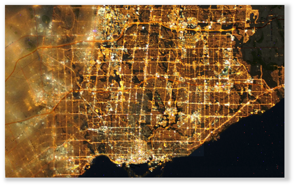
The EnerScope brand has been a part of a number of environmental GIS projects over the past years. Many of these have been analyzing direct environmental impacts of some phenomenon, where the implications have impacts on Energy, Business, Engineering, Geography and Socioeconomics. Once such projects involves the ongoing mapping of the GTHA to assess light pollution around the area as the city expands and the impact of that expansion on ecosystems and habitats around the Great Lakes Region.
The City of Toronto through its Light Pollution Initiative was looking to reduce the lighting footprint and impact of light pollution and skyglow around the GTHA. Through collaboration with Fatal Light Awareness Program Canada (FLAP) on its Light Out Toronto program, the effects of light pollution were modeled, inclusive of sleep deprivation in humans along with short term effects like increased risk of breast and prostate cancers, obesity, and a higher probability of early-onset diabetes. The effect on wildlife such as decreased reproduction in turtles, birds, fish, reptiles, and other insects was modeled along with deciduous trees delayed adaptation to season change because of prolonged exposure to light in shoulder seasons. Research was compiled into findings including increased risk of smog in urban areas due to heavy sky glow at night.
Photos