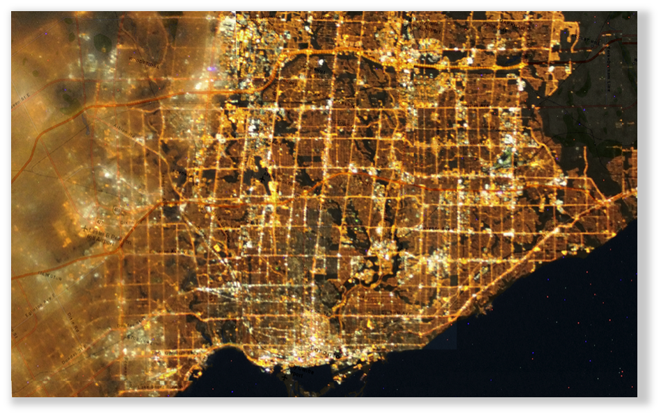
Environmental GIS is a large part of what we do. This project is an ongoing analysis of the Greater Toronto & Hamilton Areas (GTHA), determining areas of light pollution and of coursed using interactive maps to show these areas.
This dashboard is in use by both research organizations and the respective cities, monitoring both their energy use from wasted street lighting and the environmental impact of light pollution. It is integral that this footprint be reduced and in collaboration with Fatal Light Awareness Program Canada (FLAP) on its Light Out Toronto program, make cities less energy intensive and more wildlife friendly.
EnerScope modeled the effects of various types of Light Pollution, along with detailed reporting on sleep deprivation in humans, along with short and long-term effects, the effect on wildlife and delayed adaptation of deciduous trees because of prolonged seasonal exposure to light.
See Photos